Roman military bases in Magna Germania
This chapter describes Roman military bases in Magna Germania, that have not yet been considered by archeology (as of June 2023).
3.1 The legionary fortress Aliso in present-day Unna
3.1.1 Identification of the location of Aliso
Roman roads linked in most cases also Roman constructions, both civilian and military nature. Often first military installations such as a legionary fortress were built, arounf which quickly also civilian settlements emerged. There craftsmen and traders lived, but also the women and children of the soldiers (Wikipedia: Roman fort). Based upon the in ‘2. Roads’ documented courses of Roman roads in Magna Germania, in a second step of he documentation of the Roman infrastructure in Magna Germania the search for military installations and Roman settlements can be started.
Presumably, many cities in the Hellweg Boerde and the Magdeburg Boerde, which are located at distinctive places at Roman roads, are based upon former Roman installations. However In ancient sources nothing is documented about such installations in Magna Germania, and without further clues, the search is difficult.
The only exception is the legionary fortress Aliso, that played an important role related to the Battle of the Teutoburg Forest, and therefore is mentioned in some ancient sources. Aliso, where the survivors of the Teutoburg Forest Battle had fled, was besieged in the aftermath of the Battle by the Germani, but kept the siege. Even unarmed men, women and children were on in the camp (Cassius Dio 56, 22). Only when the food supplies ran out, the Romans were forced to flee to the Rhine. These details can draw some conclusions about the location of Aliso:
– Aliso as refuge for the survivors of the Teutoburg Forest Battle points to a location in northern Germania. As the survivors wouldn’t have fled to the east, thus even deeper into Germania, but towards the Rhine, only areas in the western part of the province of today’s Westphalia come into consideration.
– As after the siege an escape to the Rhine was possible this indicates to a relative proximity to the Rhine, which points again to a location in today’s Westphalia.
– The long and unsuccessful siege indicates a strong fortification, it therefore can be presumed, that Aliso concerned a garrison.
– Because many civilians were staying in the camp is to be assumed that around the camp, a greater civilian settlement was built.
To further render more precisely the location of Aliso, it must first be clarified where the deployment of a legion in a garrison would have made sense.
First of all military aspects have played a role. For the function of the garrison a fast communication to the Rhine was important, in case of war also a fast tracking of additional troops from the Rhine, both of Xanten (Vetera) and Neuss (Novaesium), Aliso therefore was located at a crossroads of the roads from the Rhine to the Westphalian bay. This consideration is also supported by the statement of the historian Cassius Dio, that the Germani kept an eye on the routes of advances (ie majority) when during the siege of Aliso rumors arosed that Tiberius had an army on the march (Cassius Dio, 56, 22, 2b).
Logistical aspects have played another important role, the camp indeed needed to be operated, short supply routes were therefore important. As like in ‘2. Roads’ explained the constructed Hellweg was the main economic artery of the Westphalian bay, for the supply of a military camp a location directly on the Hellweg near the Loess plains (Hellweg Boerde) was ideal, thus near the agricultural heartland of the new province. However, sometimes even heavy supplies had to be transported, which was much easier by ship than by land. Thus a relative proximity to the main waterway of the Westphalian bay, the river Lippe, was also important.
Also the consideration of the requirements of the civil settlement is important to clarify the location of Aliso.
As the Roman Empire was an agrarian society, most of its citizens were employed in agriculture, which was valid also for Aliso. Even more so if in Aliso veterans were settled, to which after the end of their service a piece of land was allocated.
Thus, since most of the residents of Aliso were working in agriculture, Aliso was located there where these people have tilled their fields. Therefore around Aliso there had to be soils highly suitable for agriculture. This was the case in the Loess areas of the Hellweg Boerde, which had the best soils of the Empire after those of the Wetterau.
For the location of Aliso thus result the following criteria:
– Location in the Hellweg Boerde
– Location on a traffic junction
– The smallest possible distance to the Rhine
– The smallest possible distance to the Lippe
The above criteria had been fulfilled in the present-day Unna. Unna is located at the crossing of the Westphalian Hellweg with the roads to Xanten and Neuss, regarded from the Rhine at the beginning of the Hellweg Boerde, fast communication to the Rhine and short supply routes from the Hellweg Boerde were given. Due to its location in the Hellweg Boerde around Unna also good farmland was available. On the other hand with a air-line distance of about 13 km Unna was located close enough to the Lippe, to transport heavier supplies from the Rhine over the Lippe and then just a short distance by road.
Fig. 3.1-1: For a legionary fortress advantageous location of Unna at the crossing of the streets (brown) to the Rhine in relation to the Rhine and Lippe (blue) and the Hellweg Boerde (green)
Also according to the documentation of protohistoric road network in the Westphalian bay in Fig. 2.3-1 Unna would have met the criteria described above, also on this card, seen from the Rhine, Unna is the first major traffic junction in the Hellweg Boerde.
3.1.2 Search for evidence of a former legionary fortess
This raises the question of whether still evidence for a former legionary fortress can be discovered in Unna. Especially the trench-wall-construction given by the outer protection of a legionary fortress and the only a little weather-prone paved interior roads of the fortresss may have left in a constantly inhabited environment traces until today.
Actually, in the town plan of Unna a symmetrical structure with parallel and perpendicular intersecting streets (Beethovenring, Käthe-Kollwitz-Ring) can be recognized, which is with regard to the dimension and proximity to the city center (the structure does quasi include it) very eye-catching and in comparison with other Westphalian cities unique:
Fig. 3.1-2: Symmetric structure in the city outline of Unna, atypical in dimension and location for city centers of comparable cities
In the structure shown above, there are some abnormalities:
– The streets ‘Obere Husemannstraße’ and ‘Westring’ which are completely independent of each other have exactly the same orientation, they are in line with each other
– That line is crossing the Massener Straße in an exact right angle
– That line intersects the route between the crossing ‘Beethovenring / Massener Straße’ and the market square of Unna in the middle
– This line is also parallel to the roads ‘Beethoven Ring’ and ‘Käthe-Kollwitz-Ring’ which therefore intersect the ‘Massener Straße’ also at a right angle
– The dimension of this structure is as large as the center of Unna
– the structure is oriented north-south and west-east
Conclusion: Either very many coincidences are coming together here, or the whole thing was planned.
3.1.3 Image of the structures of Aliso in the city-outlines of the present-day Unna
If the structure shown above was planned, the structure would match very well with the image of a legionary fortress. The dimension of the supposed fort would match the size of other forts of the time, e.g. the well-documented legionary fortress G1 in Neuss (Livius: Novaesium).The side length of the rectangle is with 593 m almost exactly equal to 400 Roman passus (the Passus was a standard unit of measurement of the Romans).
Fig. 3.1-3: Legionary fortress Unna
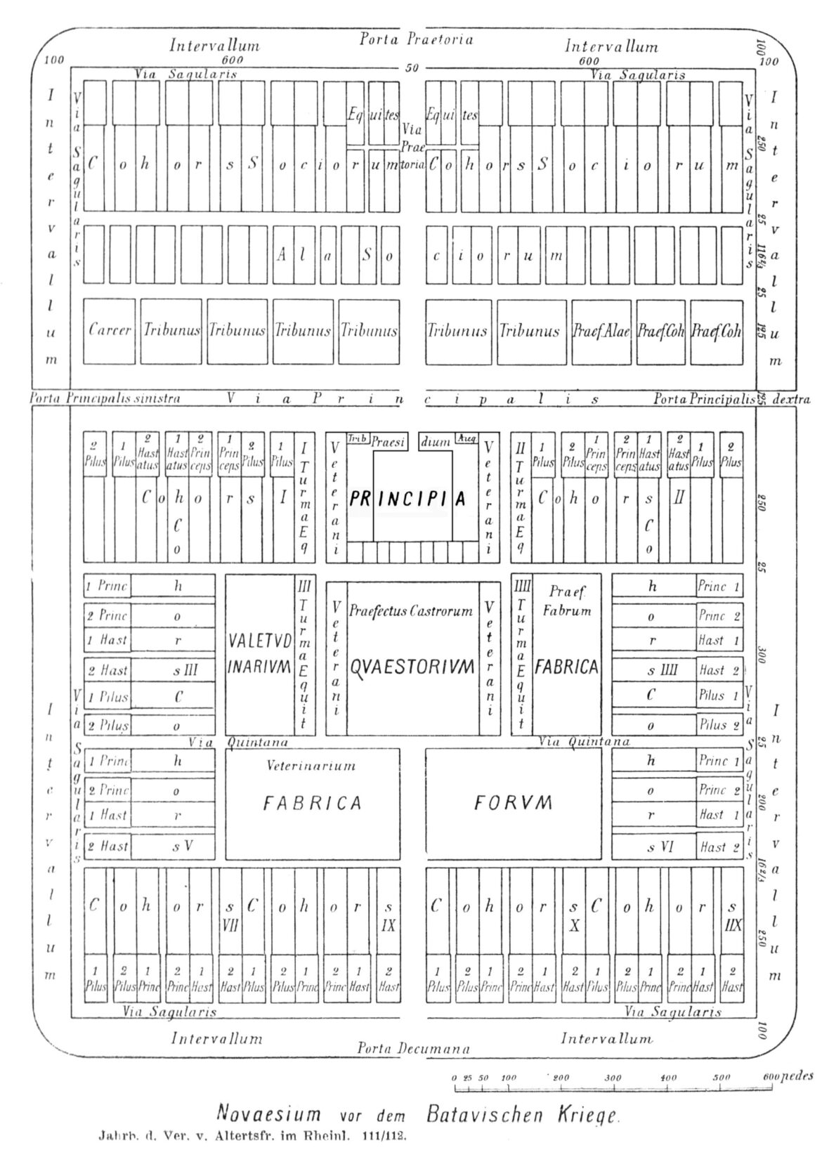
Abb. 3.1-4: Legionary fortress (G2) Novaesium, Constantin Koenen, Novaesium BJ 1904 S 33 Überarbeitung 2010
Based on Beethovenring and Käthe-Kollwitz-Ring as part of the outer walls of a legionary fortress, it is possible, based upon the model of Pseudo-Hyginus or also on the plans of other forts from th 1st Century (e. g. Novaesium), to determine the further structure of the legionary fortress Unna and its orientation by comparing other distinctive points and road profiles with the structure of other forts from this time.
Since the Porta Praetoria according to Wikipedia: Roman fort was located always in the middle of the enemy facing side of the fort, the Via Praetoria has also passed through the middle of the fort. The only recognizable street that is symmetrical to the presumed outer walls of the fort, and that has visible exits is the Massener Straße. Since these exits are not located in the middle of the outer wall, the Massener Straße was the Via Principalis, as the position of this Via was variable. Thus the Porta Praetoria has faced to the south.
The length of the fort was as shown 400 passus (593 m), the width is assumed with 370 passus (547 m). At this width, the Via Praetoria is 185 passus = 274 m away from the western outer wall, and based upon the model of Pseudo-Hyginus it is consistent quite well with the present-day streets ‘Obere Husemannstraße’ and ‘Westring’:
If the street coming from Werl / Büderich is continued linearly, it ends, crossing exactly the city church of Unna, at the square in front of the Porta Principalis Sinistra, the present-day market square. Presumably, this place also in Roman times was already a trading place, where the Roman soldiers traded with the local people. Also after the withdrawal of the Romans the marketplace was kept, and therefore was as a marketplace surely the starting point of the urban development of Unna. That’s why the eastern outer wall today in the city outline of Unna cannot be recognized any more, the eastern part of the camp was overlaid by Unna, which started to develope around the square in front of the Porta Principalis Sinistra:
Fig. 3.1-5: Overlay of the eastern part of the legionary fortress by Unna developing around the square in front of the east gate / marketplace
3.1.4 Importance of the adjacency of a river for a legionary fortress
The adjacency to a river was advantageous for a Roman fort, but it was not a requirement for its establishment. Rather legionary fortresses were built in places where the deployment of a legion was strategically necessary. These strategic places were, however, often located at rivers. First, because a river formed a natural boundary that the Romans wanted to secure, as it was the case with the forts at the Rhine. Secondly, because the Romans, due to the lack of roads, advanced along river valleys in areas that were on their conquest plan, as it was the case with the forts at the Lippe.
Water in the form of drinking and service water of course was very important for a legionary fortress, however for this even a smaller stream or enough groundwater were sufficient.
The question remains whether the Romans were able to build and operate a legionary fortress without the transport of construction materials, equipment and food over a river? Of course this was possible, it was just a littlebit more expensive. The transport of goods via a river was more efficient, however via mule transports it was not impossible. In most cases a continuous transport from the production site to the operation site over waterways was not possible, and some legs of the transport route anyway had to be covered by land.
Furthermore, the transport efficiency disadvantage was only during the construction of the fort really significant, when heavy goods / components had to be transported. For the operation of the fort only spare parts and food products had to be transported, which worked quite well by mule and wagon. The disadvantage was even lower when most foods were produced locally. For this reason, a fort including the almost always at the fort developing civil settlement close to major agricultural production areas (like that in the Loess areas of the Westphalian bay) was on a long-term operation even more efficient than a fort at a river, where the agricultural areas were far away. Aliso was intended for a long-term operation.
Legionary fortresses in Spain or North Africa also often had to do without rivers, e. g. the legionary fortress in Lambaesis. Also the Roman fortress Hedemuenden could not be supplied by waterway during its existence of about 11 to 7 BC.
The harbour of Aliso
Thus a river was not absolutely necessary for the operation of a legionary fortress, however a location near to a river did also not hurt, that is why the legionary fortress Beckinghausen located at Luenen on the river Lippe, also known as ‘riparian fortress’, probably was the harbour of Aliso. The way between Aliso and its harbour leading via todays Kamen was just like the ways inside of Aliso probably paved and remained for this reason like the ways of Aliso for a long time. In the also by Gallic elements influenced language of Romance settlers (s. chap. 1.5) this way could have been called ‘camminus‘, of which name later the name of the city Kamen originated (11th century ‘carmine‘).
3.1.5 Meaning of the trench-wall-construction for the preservation of the structure of the legionary fortress
The trench-wall-construction that has surrounded the fortress was crucial for preserving the structure of the fortress. Much more than a wall, a trench is a very formative moment for a landscape. A wall is removed fairly quickly, stones are always needed. A trench is filled that quickly. Nothing is gained except a flat surface, which is available behind the trench without any major work anyway. Therefore a trench remains pretty long and is often removed only by natural erosion: nothing is more permanent than a hole. Ways and roads which develops from them are based on the trench. With continuous settlement the ways will still remain when the trench is long gone.
Also the streets paved with gravel and stones within a Roman fort are critical to maintaining its structure, as they are weather-prone in a relatively low level. Paved Roman roads still exist today. An example for maintaining a interior street of a fort up to the present time is the Roman fort Heddesdorf, where the present Geschwister-Scholl-Straße (formerly Hintere Behring) corresponds to the course of the via principalis.
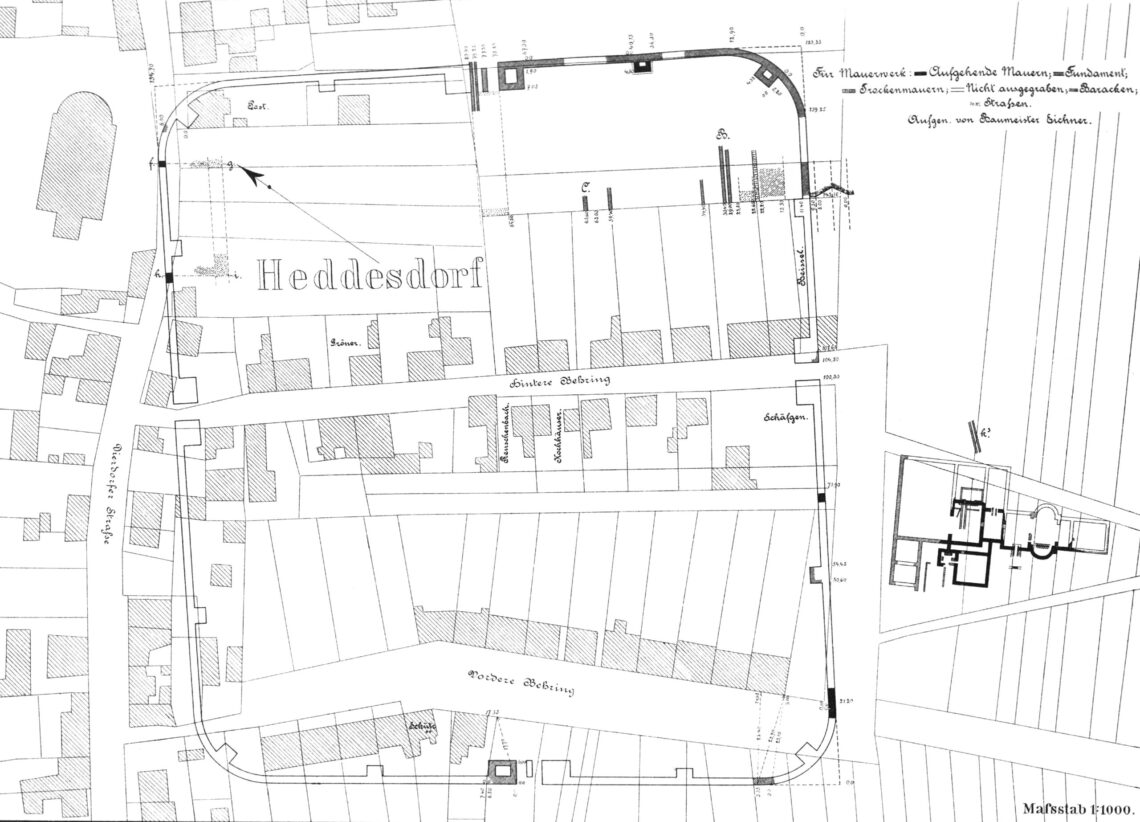
Fig. 3.1-6, Location map of the legionary fortress Heddesddorf, Robert Bodewig, ORL 01 tab 02 pic 01 Grundriss
Regarding Unna one has to imagine the following:
35 AD, about 20 years after the withdrawal of the Roman army to the Rhine frontier and the resulting abandonment of Aliso. Unna consists of a few houses, focusing on the area around the former Porta Principalis Sinistra and the square in front. It is now only respectively again a small station/village on the Westphalian Hellweg. The timber-framed building of internal constructions of the fort are already mostly collapsed, but the original 18-meter wide paved Via Praetoria and Via Principalis are still passable. The Hellweg still runs in east-west direction through Unna, so the Via Principalis is continued to be used as a road westward. Around the fort there is still the trench and the wall, on which the heavy wooden palisades now slowly are rotting. If you on the way to west want to turm to the north or to the south from the Massener Straße, you either have to climb over the ruins of the internal constructions and over the wall, or you wait until you have reached the Porta Principalis Dextra, and then move along the trench to the north or south (today Beethovenring resp. Käthe-Kollwitz-Ring). In this manner a way forms. And since Unna has been continually inhabited by the Hellweg, the ways remained, even when trench and wall had disappeared by erosion or construction.
3.1.6 Forming of ways influenced by a trench-wall-construction on the example of the Limes
With the Limes another example of a trench-wall-construction is known that affects influential even after 2000 years the infrastructure of a landscape, often present-day routes/roads and border districts are based on the course of the Limes:
Fig. 3.1-7: Course of the Limes in Alfdorf
Fig. 3.1-8: Course of the Limes in Herlikofen
That the Limes was existing much longer (about 150 years) is irrelevant for the way formation. At the time of leaving by the Romans in fact both the Limes and the legionary fortress were consisting of an intact trench and an intact wall, on which there was an intact palisade. Then began the process of decay. The initial condition for a potential way formation thus was the same in both cases.
3.1.7 The name of Aliso
The legionary fortress Aliso was named after the river at which it was built, the Elison. To be specific Cassius Dio reports about the construction of a legionary fortress at the river Elison: “Drusus accordingly conceived a scorn of them in his turn and fortified a stronghold against them at the point where the Lupia and the Eliso unite, and also another among the Chatti on the bank of the Rhine." (Cassius Dio, Roman History, 54.32.4). The only legionary fortress which was built by Drusus at the confluence of the Lippe with another river is the legionary fortress Oberaden at the confluence of Lippe and Seseke. As a result, the Seseke must be the Elison.
However, the fort Oberaden was abandoned again as early as 8 BC, that’s why Oberaden cannot be Aliso.
The legionary fortress Unna however, is located nearby of several upper reaches of the inflows the Seseke, e. g. the Massener Bach and the Kortelbach, so it was at least in the catchment area of the Elison. Since it is not known what was the main river Elison for the Romans and what tributaries, it could be that the legionary fortress Unna was located close to the Elison.
The name of Unna
The relationship between the name Elison and the name Unna might be a sesult of Gallo-Romance influences, s. chap. 1.4. The name Elison could consist of 2 parts, on the one hand from the Indo-European root word [h]elis (Alder), on the other hand from the Gallic suffix for source or water, -onna; the suffix -onna is still today reflected in many names of French rivers (Garonne, Saône, Yonne).
Since alders often grow near creeks and therefore a growth of alder was probable also at the Seseke, Gallic auxiliaries could have shaped the name Elisonna upon reaching the Seseke, meaning ‘Alder Creek’. Since river names are mostly masculine in Latin, Elisonna became officially Elison. However in the language of the Gallo-Romance settlers (s. chap. 1.5) the name remained Elisonna, from which the name Eonna developed over the centuries, similarly like the present name of the Yonne River developed from the ancient name Ica-ona. In the late 7th century the area around Unna came under Saxon influence, and since 2 vowels at the beginning of a name sounded strange in the Saxon language, the name Eonna developed further to Unna.
Also the name of the Alisontia (now Elzbach) described by the Roman poet Ausonius in the area of the Celtic Treveri is probably Celtic origin with the meaning ‘alder’.
3.1.8 Proof of the theory
To prove the theory the discovery of the remains of the legionary fortress would be of advantage. Probably not too much thinhgs can be digged in Unna, and this would have also be done earlier. Also a fortress like Aliso was mostly created as wood and earth construction, and renewed from time to time (Wikipedia: Standlager). The fortification was therefore only consisted of trench and earth wall with palisades. Besides the contour on which the later streets were beased upon, nothing remained. Likewise e.g. Alfdorf under the “Pfahlstraße" or in Herlikofen under the street “Am Limes" there will be nothing to be found.
Furthermore Dio reports, that the fort was looted by the Germani thoroughly after it was besieged after the Teutoburg Forest Battle and then abandoned by the Romans hastily (Cassius Dio 56, 22,3): “And they would all have perished or been captured, had the barbarians not been occupied in seizing the plunder."
The initial approach was to proof the theory theoretically by collecting old maps of Unna.The thesis for this was, that the earlier the symmetrical structure of such a dimension (formed by Beethovenring, Käthe-Kollwitz-Ring und Massener Straße) at a traffic junction of Roman roads (see Figure 2.4-3) is detectable, the higher is the probability that also this structure is of Roman origin.
This approach, however, was not effective, as historical maps are rather poor, and the validity of such maps is correspondingly low:
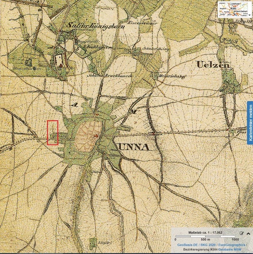
Abb. 3.1-9: Unna 1840 (Tim-Online)
The Beethovenring with its distinctive rectangular meeting with the Massener Straße is, however, clearly visible on the map of 1840, this detail seems to have been important be the designer of the map.
An important indicator of the accuracy of the theory is the location of the Battle of the Teutoburg Forest directly east of Unna (s. Annex A). Furthermore to one of the most important places in the context of the Battle of the Teutoburg Forest, the grave mound built by Germanicus for the fallen soldiers of the Teutoburg Forest Battle, there is a geometric connection, the Via Principalis of Aliso (todays Massener Strasse) points exactly to the Varus grave mound, represented by the red line in the following graph:
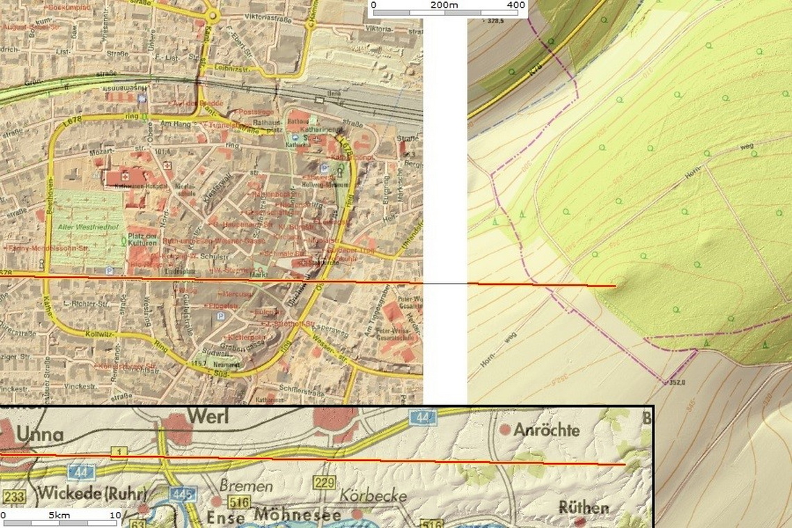
Fig. 3.1-10: Geometry between the Via Principalis of Aliso and the Varus grave mound
To try for yourself: the TIM-Online Projekt, to open under https://www.tim-online.nrw.de/tim-online2/, Extras | Import Projekt.
Possible Roman survey lines (decumani) in Germania: https://drive.google.com/open?id=1r1uWGdGv1Fz9D3hn8WzWP0BoOr_2OJyc&usp=sharing
3.2 The Roman fort crossways Haarweg / Kriegerweg
Similar to the Limes, for the military protection of the Hellweg Boerde a dual strategy made sense for the Romans. Firstly through central legionary fortresses, which were a demonstration of power due to their size, suited to intimidate the Germanic population in a large area. Secondly, through decentralized (cohort) forts, easily to supply due to their relatively small size, and from which the soldiers could then operate locally military surveillance and reconnaissance.
Similar to the Limes, it would have been useful also in the Hellweg Boerde to build these forts at the boundaries of the areas claimed by the Romans, in order to stop potential enemies invading from the interior of Germania at a early stage. In the area of Hellweg Boerde these forts would have been located, for example, on the border between the Hellweg Boerde and northern Sauerland, e. g. on the Haar.
For a more exact determination of the location of the forts again a further comparison with the Limes forts helps. Forts along the Limes were partially in visual contact with, or at least near to, high watchtowers (higher than the standard Limes watchtowers) constructed on elevations and hills, which towers were part of signaling chains in turn.
Since large groups of enemies because of the equipment could not move freely in Germania, they had to move on the ancient highways, which had over the years crystallized out on the basis of their capacity as elevated roads as long-distance routes in Germania. Therefore, it made sense to build the forts at those places, where ancient highways crossed the boundaries of the areas claimed by the Romans, because enemies most likely would invade on these routes.
An example of a fort near to a (signal chain) watchtower at the intersection of the Limes with an ancient highway (Hühnerpfad) is the Roman fort Kapersburg.
For a signal chain watchtower on the Haar the highest elevation of the Haar is suitable, the ‘Spitze Warte’. From a watchtower on the Spitze Warte there would have been intervisibility with another watchtower on the location of the present-day Bismarck Tower at Delecke in 25 km distance, from where there would have been intervisibility with another watchtower on the location of the present-day Bismarck Tower at Strickherdicke in 25 km distance, from where there is intervisibility with Unna/Aliso (verifiable e. g. with Google Earth). The Spitze Warte therefore would have been suitable for a combination of signal chain watchtower and fort.
In addition, at the Spitze Warte the ‘Kriegerweg‘ and a branch of the ‘Herßweg’ intersect the ‘Haarweg’ and thus the frontier of the Hellweg Boerde important for the Romans, therefore the Spitze Warte would also have been well suited for a fort for monitoring traffic routes from the interior of Germania.
Fig. 3.2-1: Advantageous location for a watchtower (green) and a fort (yellow) at the intersection of Haarweg (blue), Kriegerweg (purple) and Herßweg (red)
A Roman fort at the Spitze Warte would have been a wood and earth construction which was in operation 2000 years ago for about 10 to 15 years, accordingly rare finds in the form of artifacts should be in this area. Similar to the Roman camp Kneblinghausen the trench-wall conditioning and postholes of the timber-framed buildings of the possible fort might be in this case the only traces that still point to a fort. Since the remains of a trench-wall construction because of the size today would be still to recognize best, the search for archaeological evidence for a fort at the Spitze Warte first should focus on that.
The following, also on Google Maps rudimentary recognizable crop marks documented on an acreage between Kellinghausen and Hemmern at the ‘Spitze Warte’ could point to a trench-wall construction. A review with the owner of the acreage found that a modern use of the area (buildings, silages) can be excluded as the cause of the crop marks.
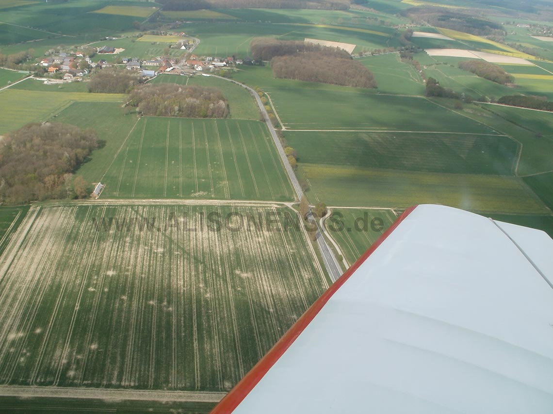
Fig. 3.2-2: Crop marks between Kellinghausen and Hemmern (April 2014)
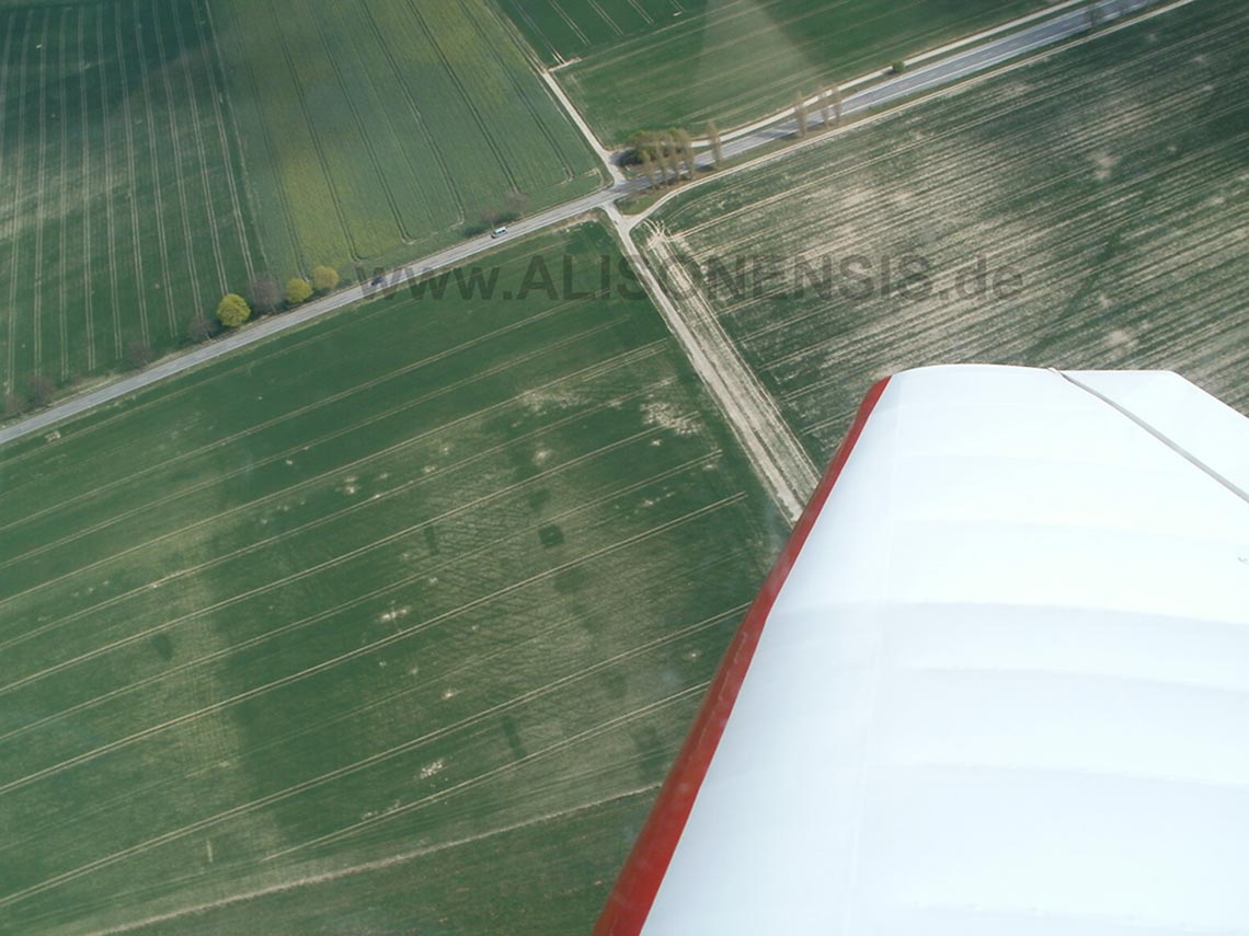
Fig. 3.2-3: Crop marks between Kellinghausen and Hemmern (April 2014)
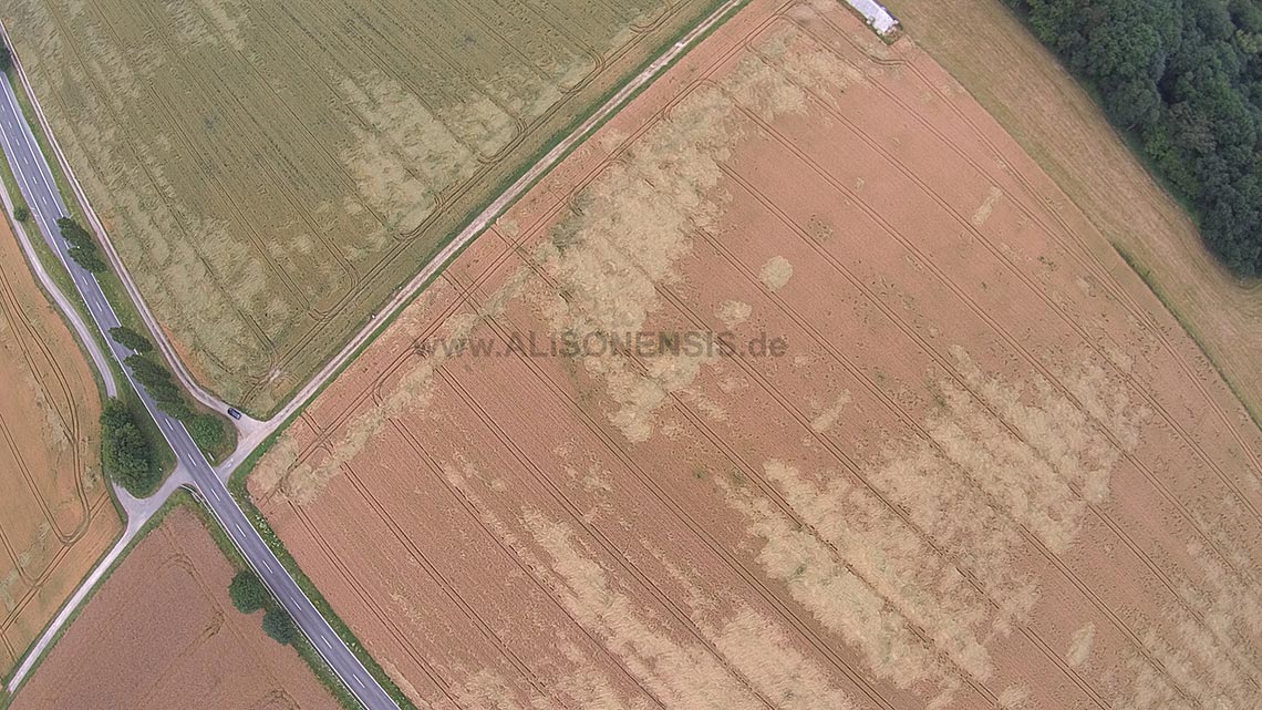
Fig. 3.2-4: Crop marks between Kellinghausen and Hemmern (July 2014)
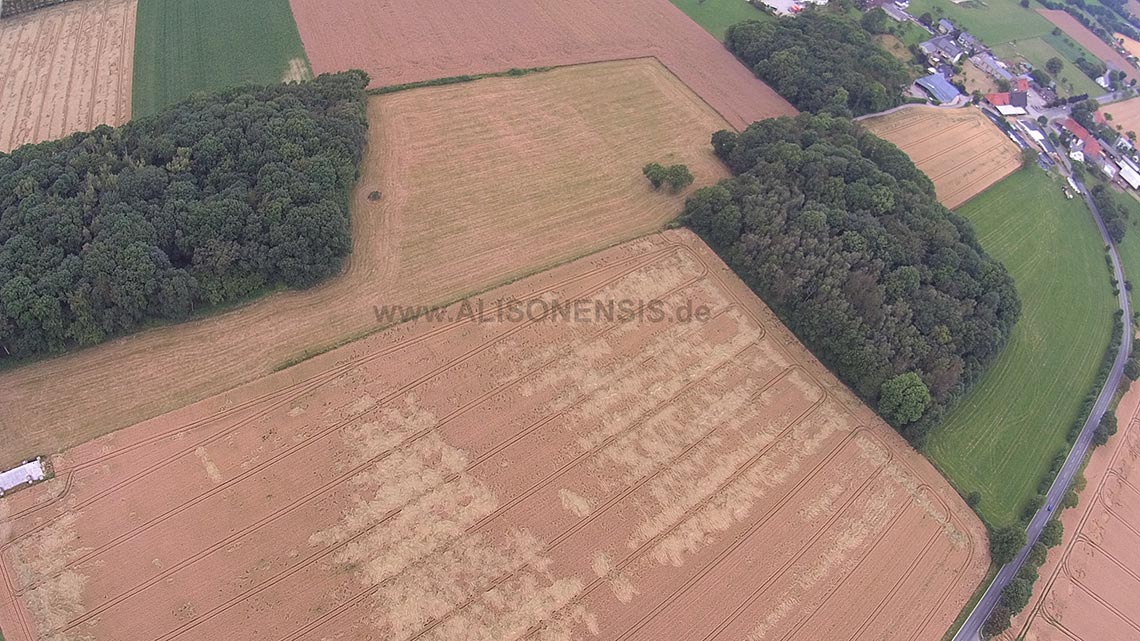
Fig. 3.2-5: Crop marks between Kellinghausen and Hemmern (July 2014)
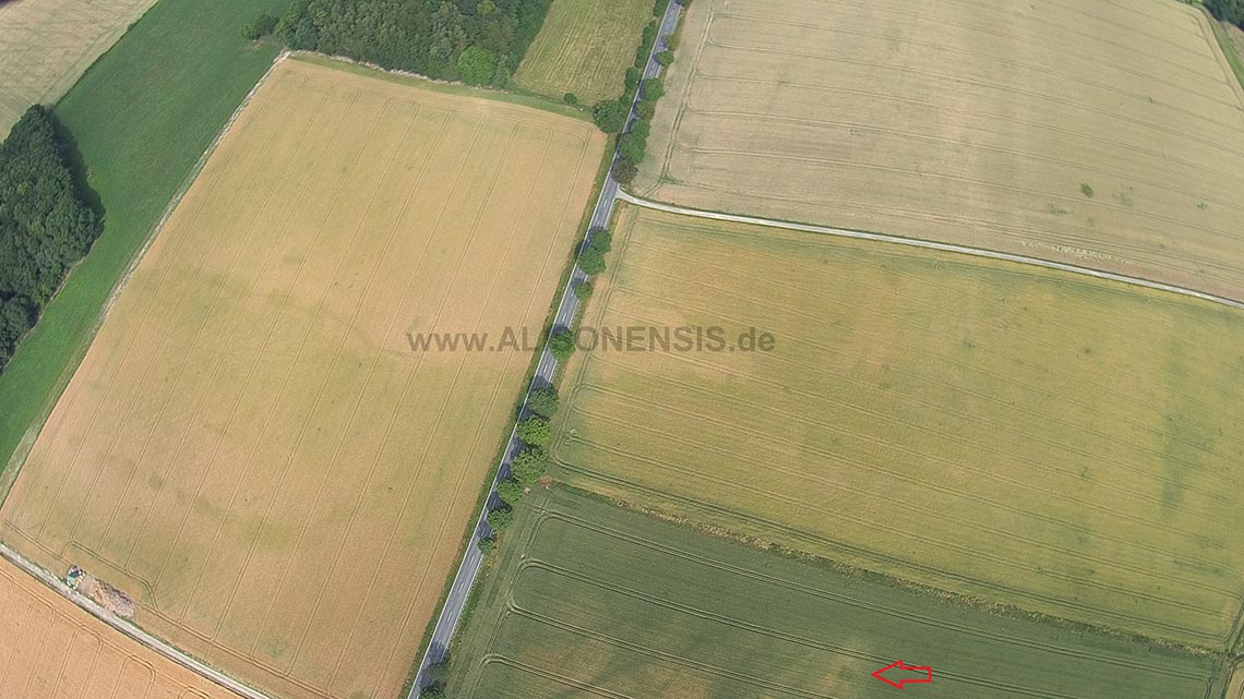
Fig. 3.2-6: Crop marks between Kellinghausen and Hemmern (July 2015)
The different levels of maturity of the grain apparent in Fig. 3.2-5 indicate different soil qualities. Since the crop marks are sharply defined and geometrically, also the soil qualities respectively the soils are sharply geometrically defined. Such delimitation can not occur by natural erosion and therefore was artificially induced. An explanation for this is the topography of the field, which suggests that in this area a flat surface was prepared by the removal or / and application of soil:
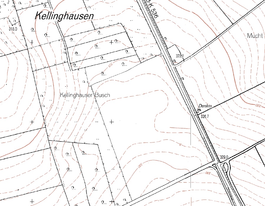
Fig. 3.2-7: Topography south of Kellinghausen (TIM-online)
A magnetic prospecting of the area yielded the following results:
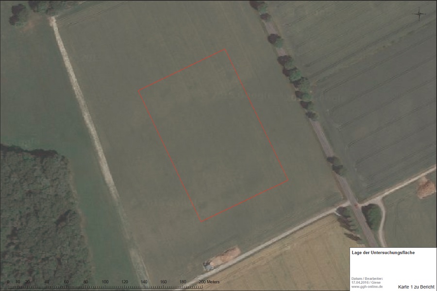
Fig. 3.2-8: Magnetic prospection Kellinghausen, location of examination area

Fig. 3.2-9: Magnetic prospection Kellinghausen, magnetogram (as Google Earth file – install Google Earth and klick on the downloaded file)
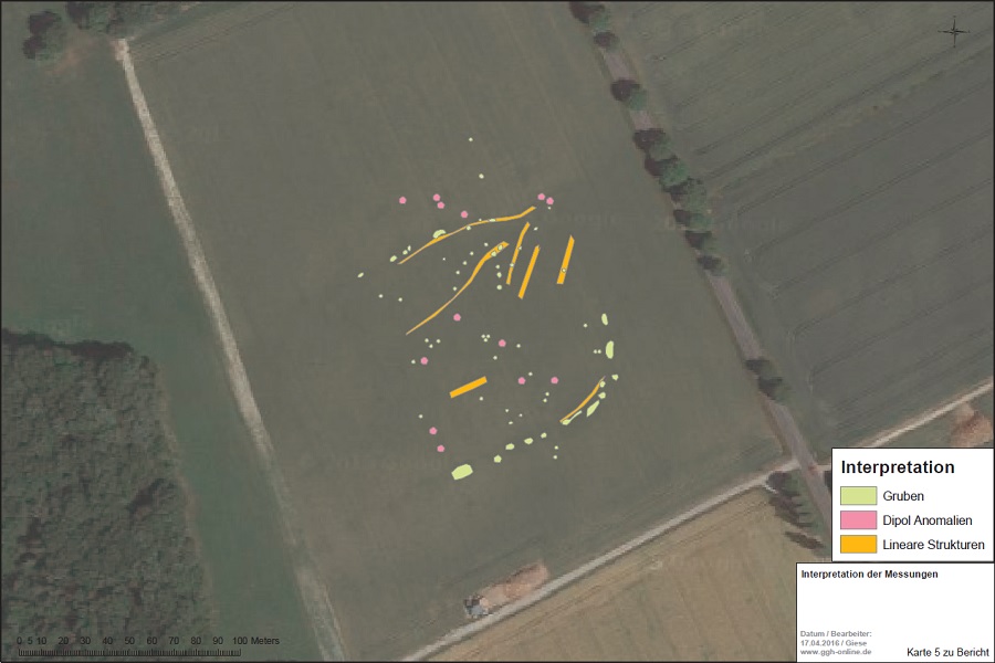
Fig. 3.2-10: Magnetic prospection Kellinghausen, interpretation: pits (green), dipole anomalies (red), linear structures (yellow) (as Google Earth file – install Google Earth and klick on the downloaded file)
3.3 The Roman camp Oesterholz
Starting from the Roman Camp Sennestadt outhward along the Senner Hellweg (Sennerandstraße) at a distance of 15 Roman miles (22.2 km), which corresponds to the average daily marching distance of a Roman legion, there are the remains of another Roman camp. The Roman camp Oesterholz is located at the intersection of the north-south road Senner Hellweg (Sennerandstraße) with the west-east road Westphalian Hellweg. That these roads were also already used by the Romans indicate the Roman camp Sennestadt on the Senner Hellweg and the narrow pass Grosse Egge (before the modern era, here a wagon fleet whose axles had a standardized track width of 1.40 m had cut tracks into the rock) as a part of the Westphalian Hellweg. From the Roman camp today only the northwestern part can be recognized, and this only by means of digital terrain model (DTM) cards, such as the one provided by TIM-online:
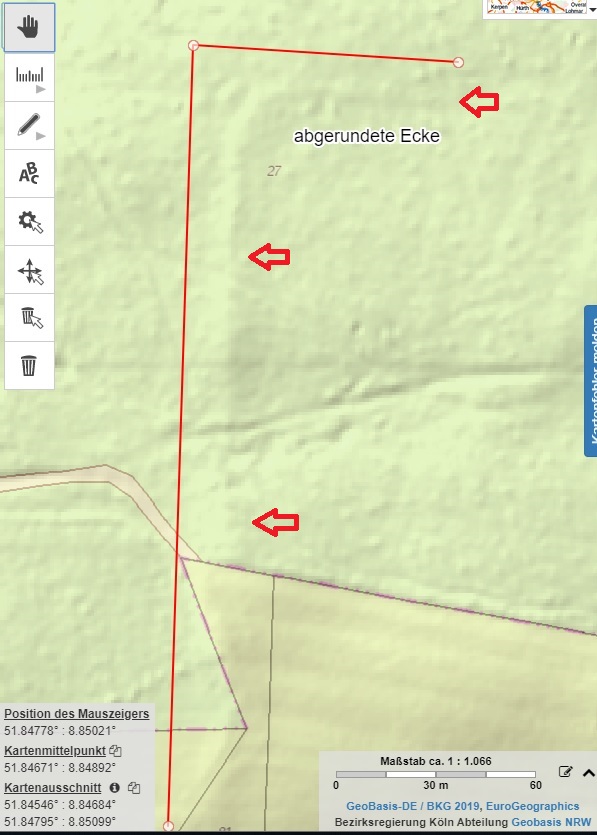
Fig. 3.3-1: Northwestern wall of the Roman camp Oesterholz in the DTM view (TIM-online) with the distinctive rounded corner (abgerundete Ecke)
The size of the wall is similar to that of the Roman camp Sennestadt on the Senner Hellweg 15 Roman miles (= 22.2 km) further north:
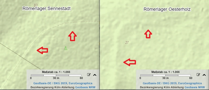
Fig. 3.3-2: Comparison of the dimensions of the walls of the Roman camp Sennestadt and Roman camp Oesterholz (TIM-online)
For Download: the corresponding TIM-Online Project, to be opened with https://www.tim-online.nrw.de/tim-online2/, Extras | Import Projekt.
The Google Map with the marked wall of the Roman camp Oesterholz:
Fig. 3.3-3: Google Map with the marked wall of the Roman camp Oesterholz (Link)
With the naked eye, there is nothing left on the wall to be recognized:
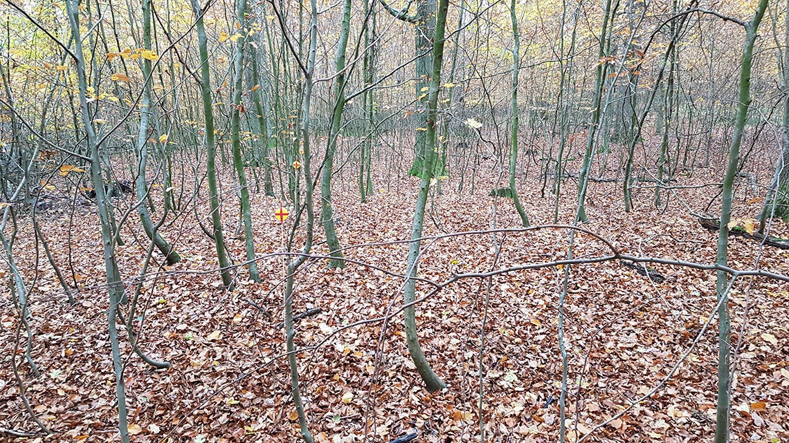
Fig. 3.3-4: Roman camp Oesterholz western wall (marked yellow-red), view from the southern end of the still preserved wall in a northerly direction
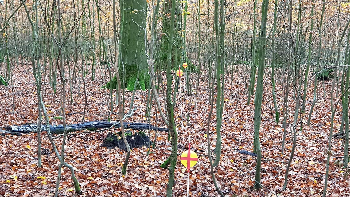
Fig. 3.3-5: Roman camp Oesterholz western wall (marked yellow-red), view from the rounded corner of the still preserved wall in a southerly direction
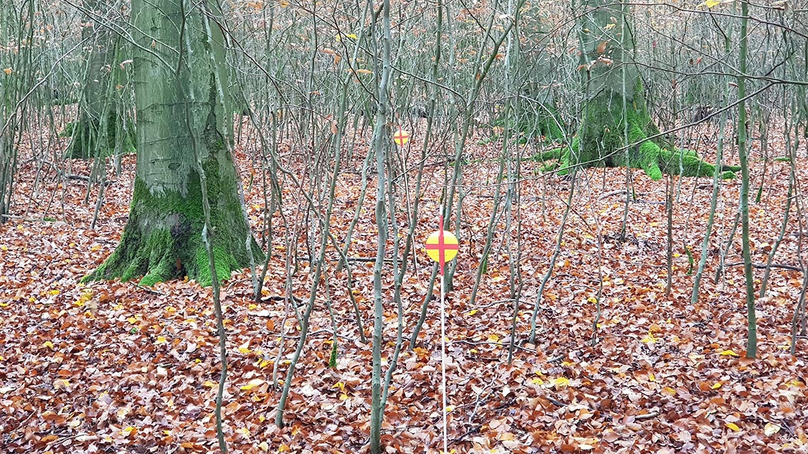
Fig. 3.3-6: Roman camp Oesterholz northern wall (marked yellow-red), view from the rounded corner of the still preserved wall in an easterly direction
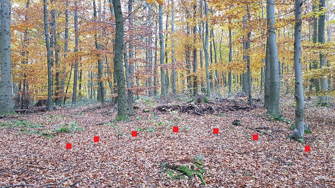
Fig. 3.3-7: Still preserved wall of the Roman camp Oesterholz
Vid. 3.3-1: Wall of the Roman camp Oesterholz, view from the rounded corner, swiveling from a southerly direction towards an easterly direction
The southern part of the camp is destroyed by plowing, a fate which the Roman camp Oesterholz is likely to share with the vast majority of Roman camps in Germania. At the end of the still recognizable part of the northern wall, the terrain begins to rise noticeably to the east, possibly the wall here was much more eroded (flow movement of the soil on a slope) and is therefore no longer displayed in the DTM.
3.4 The Roman camp at Vierhausen at the Haarweg
As discussed in chap. 2.3, the Haarweg on the northern edge of the Hellweg Boerde was an important long-distance route for the Romans. The choice of Neuss as the first Roman military base on the northern Rhine (Legion camp Novaesium) indicates, that the ancient highway Neuss-Herdecke, beginning near Neuss, and the Haarweg as its extension, were the first and most important Roman deployment route north of the low mountain range ‘German Mittelgebirge’.
Indications of a Roman camp on the Haarweg can be found near Vierhausen south of Werl. There you can see cropmarks that form a rectangle in the size of a playing card (207 m x 130 m) with rounded corners, which is typical for the ditch of a Roman camp. Probably a Clavicula gate can be seen in the western wall of the camp.
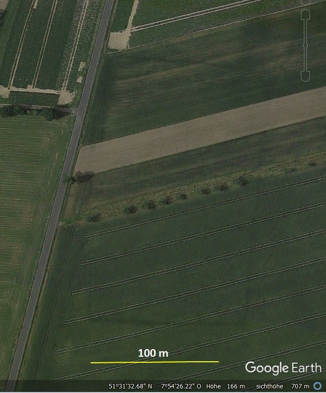
Fig. 3.4-1: Cropmarks Roman camp Vierhausen at the Haarweg (Google Earth File)
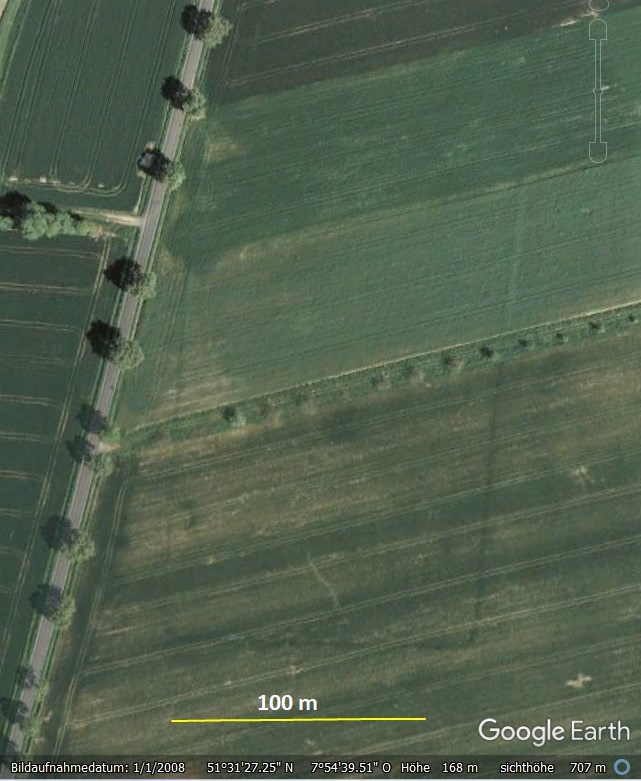
Fig. 3.4-2: Cropmarks Roman camp Vierhausen at the Haarweg (Google Earth File)

Fig. 3.4-3: Cropmarks Roman camp Vierhausen at the Haarweg, Clavicula-Gate (Google Earth File)
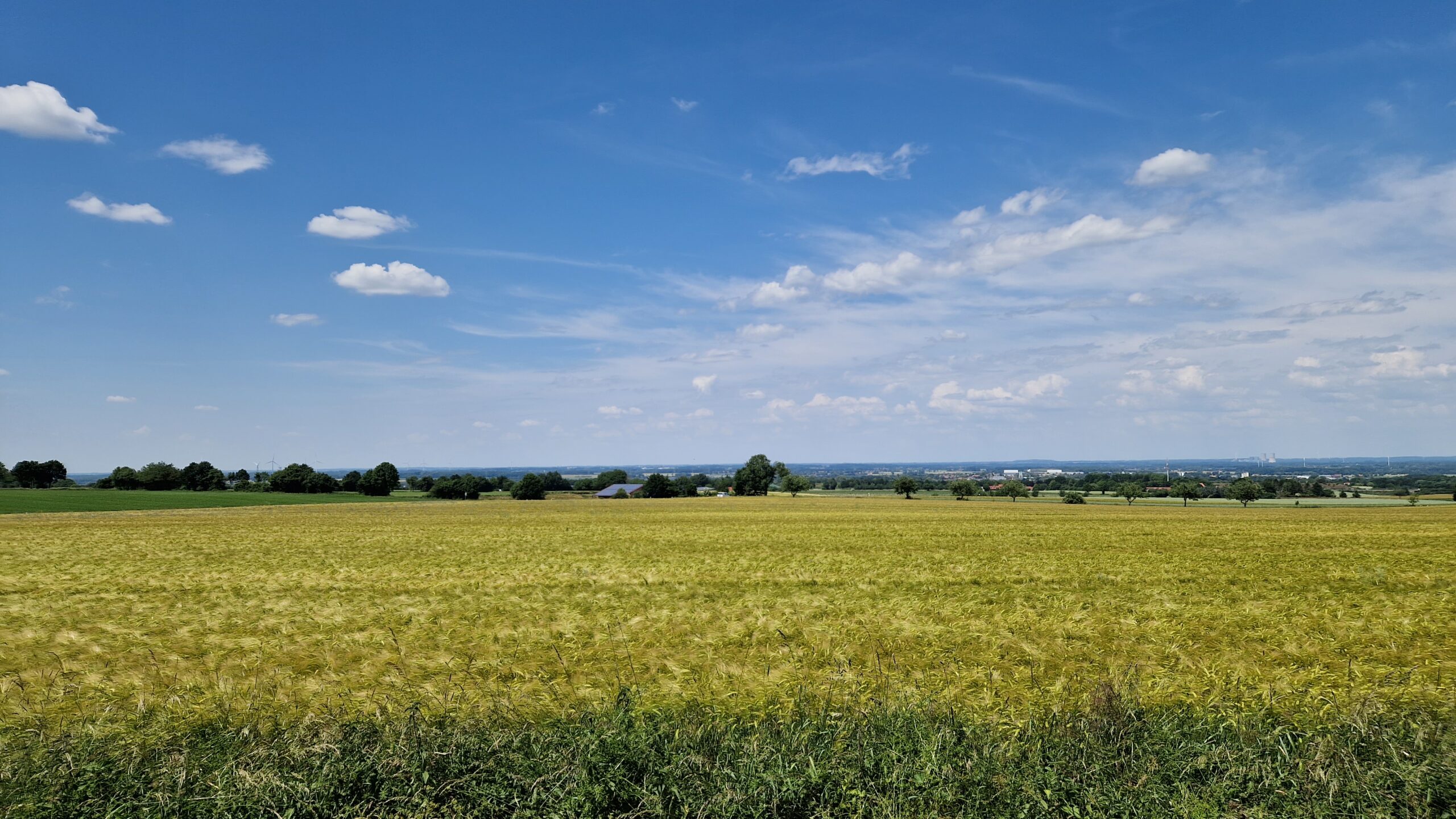
Fig. 3.4-4: Roman camp Vierhausen at the Haarweg, view from the Haarweg across the site of the camp direction north
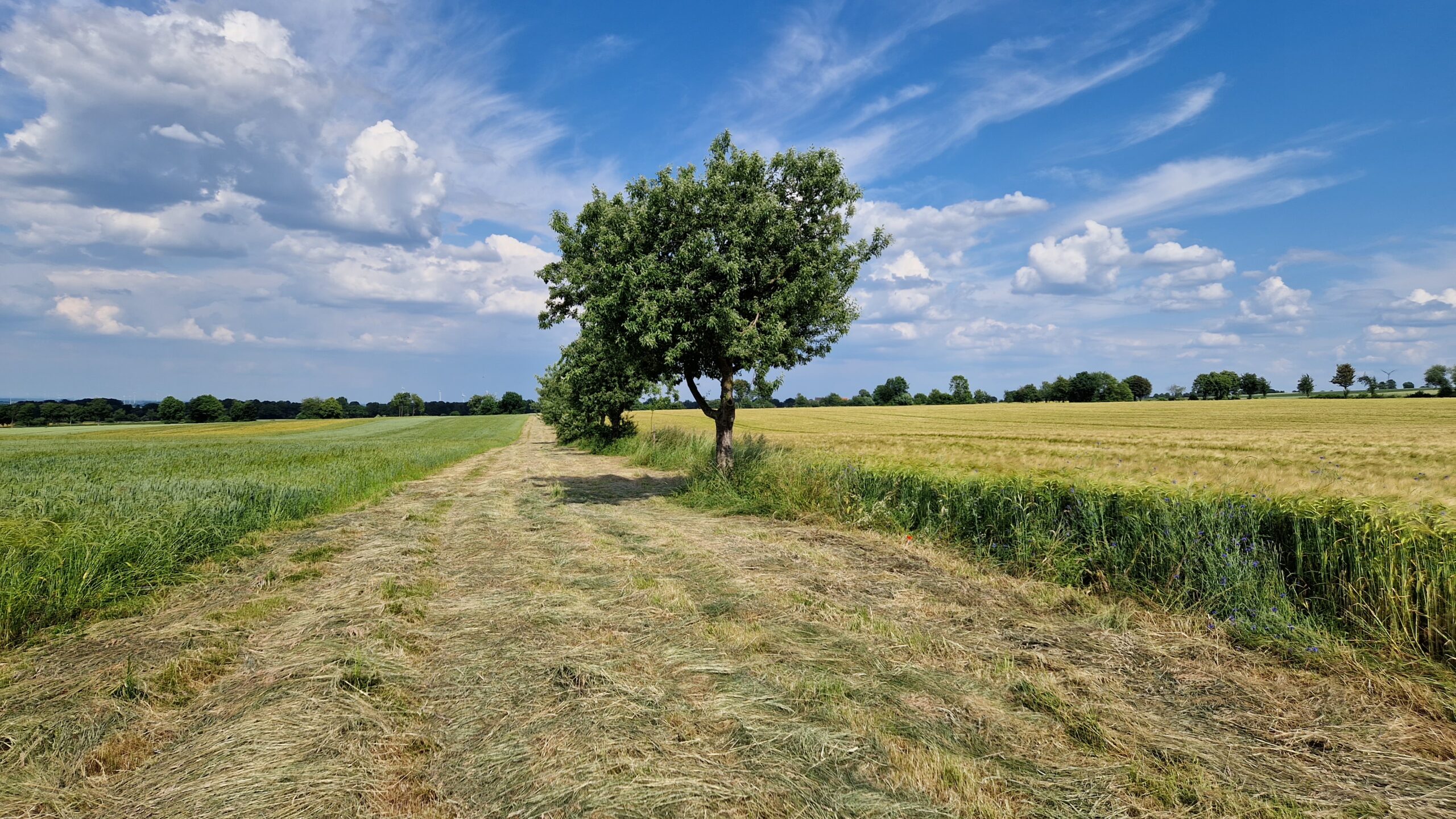
Fig. 3.4-5: Roman camp Vierhausen at the Haarweg, view from the local road K30 across the site of the camp direction east
The size of the Roman camp near Vierhausen and its location on the northern slope of a long-distance route correspond to the Roman camp at Wederath (side lengths 210 m x 148 m). Due to its size of approx. 3 ha (7,5 acres) , the Roman camp at Wederath is assumed to have been occupied by 2 cohorts, which indicates a construction or pioneer unit rather than a combat unit. This in turn indicates that the Romans often used the Haarweg as a transport route into the interior of Germania, and upgraded it according to their requirements during the occupation period.
Since the Haarweg is the extension of the ‘Pontes Longi’ causeway built in the Wuppertal depression (see Chapter 2.3), the expansion of the Haarweg is likely to be related to the construction of the Pontes Longi, so that for the construction of the construction-camp at the Haarweg a dating around the year 0 is to be expected.
The Roman camp at Vierhausen shows, that the consolidation of the province Magna Germania was already well advanced in the area of the Westphalian Basin before the Battle of the Teutoburg Forest in 9 AD and the subsequent Roman retreat to the river Rhine.
