
Magna Germania 9 AD
1.1 The Roman motivation for the occupation of Germania
The Roman province Magna Germania was not contiguous before the withdrawal of the Romans as a result of the Teutoburg Forest Battle, the Romans had brought Germania only in some regions under their control (Cassius Dio: “The Romans were holding portions of it, not entire regions, but merely such districts as happened to have been subdued…”, Wikipedia: Cassius Dio über Germanien vor der Varusschlacht).
The search for the remains of the Roman infrastructure therefore raises first the question, where those disjointed areas lay, which Cassius Dio has mentioned. However, to answer this question one must first clarify another question: What did the Romans look for in Germania?
Like all European societies from the Neolithic revolution (beginning of agriculture and animal husbandry) until the Industrial Revolution, the Roman Empire was an agrarian society, some smaller towns were each embedded in an agrarian affected environment which supplied the town with food (Wikipedia: Agrarian society). In an agrarian society the soil as agricultural land is the most important factor of production. Thus, the Romans were primarily interested in good farmland.
Furthermore, the Romans were interested in the raw materials of Germania, especially on iron ore and lead deposits which Germania abounded in. The ore which could be best smelted in the furnaces of the antiquity was hematite. An overview of the hematite deposits shows that the German Mittelgebirge in general and in particular also the northern Sauerland are rich in hematite deposits.
The Sauerland as part of the Rhenish Slate Mountains has several mineable non-ferrous metals such as lead, zinc and copper in various compression zones. These include the areas around Brilon, Marsberg, Ramsbeck and Olpe. In contrast brown and red iron ore are to be found throughout the region. In addition to the ore the numerous rivers and streams provide good conditions for the use of hydropower. The wood of the forests, processed into charcoal can be used for melting the ore. (Wikipedia: Bergbau im Sauerland)
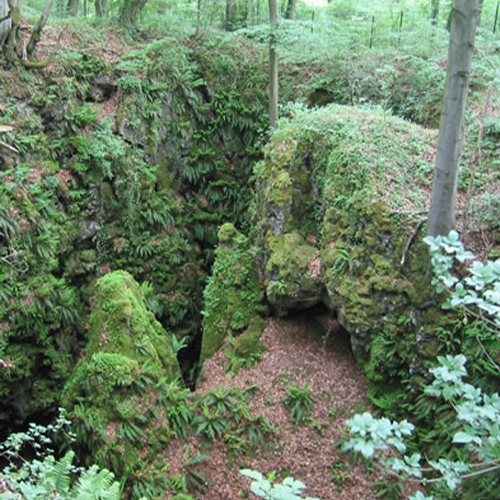
Fig. 1.1-1: Large mining sink-hole of the abandoned iron ore mine “Rome” at Oberhagen, Warstein – Enste, GrossePingeWiki, CC BY-SA 3.0
Germanic lead (Plumbum Germanicum) was known in the Mediterranean (Wikipedia: History of Brilon), lead ingots from the early Roman imperial period were found in Balve, a production chain of lead mining in the northern Sauerland and lead processing in the Hellweg Boerde is likely (LWL: Römisch-Germanische Bleiwirtschaft in Westfalen).
Datable finds, which would provide a clear evidence of iron ore mining in the occupation period, are not existing (Wikipedia: Antiker Bergbau im Sauerland). However, there are many mining sink-holes that point to a great age.
1.2 The large Loess plains of Germania as priority occupation goals
The better the soil, the more interesting the areas were for the Romans. The soil map of Germany shows where those areas were to be found in Germania:

Fig. 1.2-1: Soil map of Germany 1 : 5 000 000 (Umweltbundesamt), shown in black the Limes
The most suitable soils for agriculture are the Loess soils (German: ‘Lössböden’; Wikipedia: Loess), the best quality has the black earth (German: ‘Schwarze Lössböden’; Wikipedia: Chernozem). In the new province between Rhine and Elbe, north of the Mittelgebirge primarily the Hellweg Boerde, the Loess areas of the Weser Uplands, the Hildesheimer Boerde, and most of all the Magdeburg Boerde and the Thuringian Basin were of interest.
South of the Mittelgebirge particularly in the area in and around the Wetterau the best soils can be found. The bulge of the Limes to surround the Wetterau was indeed very unfavorable for the protection of the border, but it shows the importance of the Loess plains of Germania for the Roman Empire.
You are currently viewing a placeholder content from Google Maps. To access the actual content, click the button below. Please note that doing so will share data with third-party providers.
More InformationFig. 1.2-2: Roman province Germania Magna with the agricultural core areas, approximate extent of 9 AD
As a comparison with the soil map of Europe shows, soils with the quality of those of the Magdeburg Boerde and of the Thuringian Basin were extremely rare in the Empire:

Fig. 1.2-3: Soil map of Europe (Europaen Commission)
Due to the very good soil quality agriculture was efficient even with the farming tools which were available in the antiquity. Just as like today on black earth regularly very good harvests are achieved (e. g. in the Hildesheimer Boerde), seen in relation this of course was valid also for the antiquity with the farming methods available in those times: a culture that has the leisure to make the Nebra skydisk does not suffer from food shortages.
A comparison with the present-day France on the soil map shows, that also in the Roman province of Gaul there were no comparable easily to be cultivated soils. Therefore for the Romans in Magna Germania, at least in the Loess areas of Germania, it was much faster possible to organize and intensify the agriculture.
In addition to the taxes that could be occupied also the country as such was of interest for the Romans, as a very attractive farmland especially for retired legionaries (veterans after their 16-year service were supplied by the state and were allocated a piece of land; Wikipedia: Roman Legion); a contented army may be considered as at least an indirect economic benefit.
The establishment of a new ‘granary’ in Germania would also have had the advantage that this was in a climate zone that differed fundamentally from the climate zone of the Mediterranean and had much more constant rainfall. In case of a drought in the Mediterranean grain deliveries from Germania could have compensated shortfalls in deliveries such as from North Africa. Also for the supply of the legions north of the Alps transport costs could have been saved, when the legions would have been no longer dependent on grain supplies from the Mediterranean area.
1.3 The Hellweg Boerde as a landscape with far developed agriculture and transportation infrastructure
In the above areas, the provincialism thus began. The question remains open of where the Romans knew of the very good soils in the Loess areas of Germania. Simply because those areas were already cultivated on a large scale. Due to the easily to be cultivated soil loess areas were among the first agricultural areas in Europe (Wikipedia: History of agriculture). In addition, analyzes of pollen from this time confirm, that at least the Loess areas of Westphalia at this time were already largely developed agricultural landscapes (LWL: Westfalen zur Zeit der Germanen und Römer). A correspondingly high population density in Magna Germania must be assumed (Sonderdrucke aus der Albert-Ludwigs-Universität Freiburg: Heiko Steuer zur Besiedlungsdichte, Bevölkerungsgrößen und Heeresstärken während der älteren Römischen Kaiserzeit in der Germania Magna).
The same of course was valid on the basis of even better soils for the Magdeburg Boerde, s. a.
1.4 The Gallo-Romance colonization of Germania east of the Rhine
Gallo-Romance immigrants in Germania after the Gallic War
The Gallic war caused great changes in the political structures of northwestern Europe. Gaul was transformed into a Roman province, and also in the areas left and right of the Rhine the threat of the Romans increased, during the Gallic War Julius Caesar crossed the Rhine twice. Some tribes migrated, the rest was living in an atmosphere of insecurity and the growing influence of the Romans.
At the same time there was a group of uprooted people in Gaul, Celtic (Iberian, Gaulish) auxiliary troops of the Romans, whose numbers could be considerably reduced after the end of the war, and who were now so to say unemployed. These Celtic auxiliaries had spent much of their lives fighting for the Romans, but after the end of their service – unlike the Roman legionaries – they weren’t given land. It was therefore tempting for the Auxiliary veterans from the Gallic War to take advantage of the uncertain political conditions on the Rhine at that time and to occupy the country there – sometimes with armed force. This happened preferably east of the Rhine, where the influence of the Romans was not very large yet.
In his work Germania (29, 4), the Roman writer Tacitus indeed reports on Gallic immigrants right of the Rhine, who took advantage the unclear ownership there and occupied the country. Tacitus describes these immigrants as reckless and daring, today they would be referred to as adventurers. Such groups are usually characterized by the ruthless use of armed force: the native Germanic population was confronted with heavily armed Celtic or by their long service as auxiliary soldiers romanised immigrants.
The name given to the Gallo-Romance immigrants by the native Germanic population can be deduced from their main qualification, the immigrants presented themselves to the Germani primarily as excellent ‘fighters’. In a culture in which almost every name reflects the fight (e. g. Hildegard, Gunther), also the main occupation of the immigrants could have been reflected in their name.
The Gallo-Romance immigrants could have been known to the Germani as ‘fighters’ or ‘fighting men’. The Germanic word for fight was ‘hadu‘, the Germanic word for man was ‘ware‘ or ‘uuare’, so the immigrants may have been called ‘Haduwari’ or ‘Haduarii Since most of the immigrants came from Gaul, this should have been in addition to the self-concept of the self-designation of immigrants, the Gallo-Roman word for fighters was ‘catarius‘, based on the Celtic word ‘catu’ (fight, see Caen) and ‘viros‘ (man). The self-designation ‘Catuarii’ could have been adopted by the Teutons almost as a foreign word and used parallel to ‘Haduarii’, or ‘Catuarii’ could – assuming a smooth transition between Germanic and Celtic dialects – near the Rhine ‘Catuarii’ could also have been the native name for the immigrants.
The Germanic name for the Roman auxiliary troops in Germania
During the occupation, Germania east of the Rhine came more and more under the control of the Roman Empire, but most of the Germani did not perceive the Romans resp. the Roman legions. The reason for this is that for the pacification and surveillance of the provinces, the auxiliary troops, which made up half of the Roman forces, were deployed in small units in the area, while the legions were stationed centrally in the large legion camps (Wikipedia: Roman auxiliary troops). As a total of six Roman legions with a nominal troop strength of 5,000 each were stationed on the Rhine during the occupation, it also can be assumed that some 25,000 to 30,000 auxiliary soldiers were stationed in Germania. The Germanic tribes were in daily contact with this army of auxiliary soldiers. For the Germanic tribes, the auxiliary troops were the interface to the Roman Empire, they equated the auxiliary troops with the Romans.
On the other hand, in language and armament the auxiliary troops were hard to distinguish from the Gallo-Romans who had immigrated to Germania after the Gallic War. It is therefore obvious that the name for the Gallo-Roman immigrants was transferred to the Gallo-Roman auxiliary troops, and because of their function as representatives of Rome then was transferred to the general name for Romans.
That the auxiliary troops as representatives of the Roman Empire were called ‘Romans’ (romuuari) is not to be assumed. The abstract concept of the Roman citizenship was unknown to the vast majority of the Germanic people living in tribal societies, for them a ‘Roman’ would have been someone who comes from the city of Rome. Then it is on the one hand unclear whether the city of Rome was already known to the majority of the people living east of the Rhine, on the other hand only very few soldiers came from the city of Rome itself. Half of the Roman army consisted of auxiliary troops, who did not possess the Roman citizenship, and thus didn’t need to come from the Italian peninsula or even from the city of Rome, but often were recruited locally, that means also in Germania itself. Auxiliary troops were used widespread for pacification and surveillance of the provinces (Wikipedia: Auxiliartruppen). Thus the Germani mainly made contact with soldiers which did not come from the city of Rome, but often from the Roman provinces, or even from Germania (like e. g. Arminius). It seems unlikely that Germani had referred to other Germani as ‘originating from the city of Rome’.
Later, the Germani have understood the concept of the Roman Empire and the Roman citizenship (that is the concept of a territorial state), and the term ‘Romans’ arose.
The Gallo-Romance colonization of Germania during the occupation
As discussed above, the number of auxiliary troops in Germania was about 25,000 men, mainly of Gallo-Romance origin. The service period of the auxiliary troops was 25 years, accordingly during the approximately 25 years ongoing establishment of a Roman province east of the Rhine from about 14 BC until 9 AD there were about 25,000 veterans of auxiliary troops. There is no evidence of a land allocation to veterans of auxiliary troops in the ancient sources, but since the Gallo-Romance auxiliary soldiers spent almost their entire lives in Germania and had noticed during their service in Germania excellent agricultural areas, it can be assumed that many auxiliary soldiers did not go back to Gaul, but had taken a piece of land in Germania (especially as discussed above, many Gallo-Romance immigrants lived near the Rhine and facilitated the conquest to the second wave of immigrant compatriots). This happened parallel to the service of the Auxiliaries, along with the establishment of a family, for what it would have been too late after the end of the service.
For sociological reasons and reasons of mutual protection against the neighboring and partially hostile Germanic population, the Gallo-Romance conquest of land in Germania took place in contiguous areas. Germania was colonized Gallo-Romance. If one estimates cautiously and assumes that about 15,000 auxiliaries remained in Germania, this results, together with the wives and children, a figure of about 30,000 to 50,000 Gallo-Romance colonists of the second wave of immigration east of the Rhine, together with the first wave of immigration there could to have lived 100,000 Gallo-Romance immigrants between the Rhine and the Elbe. Such a large population of Haduarii or Catuarii should have been reflected in the ancient sources. In fact, the Roman historians report that there was such a group from Hesse over the Muensterland to the Lower Rhine: the Chattuarii (old English ‘Hetware’).
One way of finding places where the Chattuarii have stayed are place names and field names named after them. These are strategic locations, such as the heights at ancient crossroads or fords where the auxiliary troops were stationed, or the settlements of the Gallo-Romance colonists.
‘Heden/Heiden’ (heathen) as a term for Romans
One of the Germanic words for ‘fight’ was ‘hadu’ (Hathumar = the one who is famous in the fight, Wikipedia: Hathumar), also in the modification ‚hethe‘ (Hemmern [1146 Hethemere] = the village at the fight fountain, Wikipedia: Hemmern).
A well-known place where the Roman auxiliary troops have stayed is the Roman camp Hedemuenden. If you translate Hede- with fight, and -muenden with mountain (Germanic *-munt with the meaning mountain / hill / elevation, Wikipedia: Dortmund Ortsname), then Hedemuenden is a ‘fight mountain‘ oder ‘war mountain’, which a mountain with a military camp could be called, which is consistent with the location of the Roman camp Hedemuenden. The root word Hed- can also be found in the determinative elements of place names of other places that date back to Roman military camp respectively to the civilian settlements of camp: Heddesdorf (cohort fort, 962 Hedenesthorp), Heddernheim (Civitas main town; 1132 Hetdernheim), Heidenheim (fort, 8th century Heidenheim), Heidenberg (Limes fort), Heidenburg (Roman Hill Fort), Heidekringen (Roman fort), etc. Eventually also the place names Hiddestorf and Hiddenhausen could point to a Roman prehistory.
Thus the term Hede or Heide (heathen) originally could have referred to the Romans and their auxiliaries, the development from Hede to Heide is good to recognize on the place name Heddernheim, 1132 Hetdernheim, 1248 Heidersheim, s. a. However the knowledge of the presence of the Romans in Germania waned over the centuries, and the meaning of the term Heide reduced until the early Middle Ages to a group of people who lived in Germania long time ago. Thus these people lived before the Christianization in Germania, so they were not Christians, but heathens (in German Heiden). From the Middle Ages, all non-Christians were called Heiden.
Also, the root word hild- is related to today’s term fight (Wiktionary: Hildegard). Eventually place names like Hildburghausen, Römhild, Hiltrup or Hildesheim could be related to this and point to a Roman prehistory.
‘Katten’ as a term for the auxiliary troops
As discussed above, in addition to the term Chattuarii, the people east of the Rhine may have used Cattuarii as loan word from Celtic, or Chattu became Cattu due to the relatively large Celtic linguistic substrate now being formed by the many Gallo-Romance immigrants.Thus also place names on ‘Katt-‘ could have formed, e. g. Kattwig (Kettwig (1052 Katuuik), Kattwyk, Katwijk, Catwick), Kattenwinkel (e. g. Adorf, Hameln, Zwolle), Katwinkel (12th century Kathwinkel) or Kattenhagen (e. g. Brilon, Münster, Groningen), Cattenom (1182 Cathenem).
The place name Kattenvenne (836 Hadunveni, 1312 Kattenvenne) suggests that in the early Middle Ages the word stems ‘hadu’ and ‘catu’ were still used synonymously and parallel, and therefore were interchangeable. Thus the Romans and the auxiliary troops could also have been called Katten, as a synonyme for ‘warriors’ or ‘martials’.
Due to the similarity of the name Chattic Catumar with the common Germanic name Hathumar it is likely, that also the name of the Chatti itself is related with Hadu/Hathu, thus that also the name Chatti means ‘the martials’. This mixed form of Celtic and Germanic could possibly be explained by the Northwestblock Hypothesis. Also the Roman writer Tacitus describes the military discipline and organization of the Chatti compared to other Germanic tribes as exceptionally (Tacitus, Germania chap. 30).
Katt- became by the Second Germanic sound shift in Phase 1 Kass- and in Phase 2 Katz-. Thus also the often occurring place name Kassberg and also the place name Castrop could indicate a Roman history, as well as this could be the case with the late Roman fortification Katzenberg or the Kattenburg (Kassenburg, Katzenburg). The transition from Kath- to Kess- is good to recognize by the place name of Kesseler: 1183 Katheslere, 1198 Catislare, 1200 Katteslare, 1214 Katteslere,1221 Keteslere, 1221 Ketteslare, 1246 Ketteslere, 1264 Ketteslare, 1276 Katteslere, 13. JH. Keslere, 1303 Kezlere, 1308 Ketzeler, 14. JH. Keteslere, 1360 Kettesler, 1446 Kesleren, 15. JH. Ketteslere, 1823 Kesseler (Die Ortsnamen des Kreises Soest).
Since also the First Germanic sound shift regarding ,k’ to ‘h’ was apparently not completed at the occupation time (e. g. river name Vacalus became Vahalis), Kass- or Kess- could have become Has(s)- or Hes(s)-.
Interesting in this context is a hill above a ford (or on one of the fords) of the ancinet highway Hilinciweg over the Ruhr in the south of Bochum. There the place names Kassenberger Str., Am Hedtberg and Hasenwinkeler Str. come together:
You are currently viewing a placeholder content from Google Maps. To access the actual content, click the button below. Please note that doing so will share data with third-party providers.
More InformationAlso a road built by the Roman army could have been named after the Romans. To locate these former Roman roads one must first determine where there was demand for the Romans for road construction.
‘Heidenstraßen’ (Heathen Streets) as Roman streets
Along ridges at the densely populated areas important highways already existed when the Romans arrived in Magna Germania, e. g. the Haarweg at the edge of the Hellwegboerde.
However, between the Rhineland already belonging to the Roman Empire and the occupation goals in the Weser Uplands and in the Thuringian Basin there was a macrochore, which due to its relatively poor soils in ancient times was only very bad suited for agriculture and which was therefore inhabited only very sparsely, the Sauerland. Due to the sparse population density also the supply possibilities for long-distance travelers would have been very poor, thus in the antiquity no significant highways had formed through the Sauerland. For the Romans therefore there was the requirement to build new highways between the military and settlement centers at Neuss/Cologne and Mainz and the Hellweg Boerde and the Thuringia Basin through the Sauerland. Even today the names of three important prehistoric highways through the Sauerland could indicate this Roman road construction: the Heidenstraße (heathen street) leads from Cologne east toward the Thuringian Basin, the Kriegerweg (warrior way) leads from Siegen to Paderborn, and the Roemerweg (Roman way) leads from Bonn to Brilon. The synonymity of Hethe/Heide (heathen) = warrior = Roman is thus to recognize very well also in this case.

Fig. 1.4-2: Prehistoric highways in the Sauerland (Wikipedia), including Heidenstraße (Heathen Road), Kriegerweg (Warrior Way) and Roemerweg (Roman Way) – Wolfgang Poguntke 13:46, 17. Okt. 2007 (CEST), Fernwege-1, CC BY-SA 2.0 DE
If you determine with the pedestrian routing of Google Maps the shortest march distance between the known Roman whereabouts Cologne and Hachelbich, there results exactly the course of the Heidenstraße via Wipperfuerth, Marienheide, Meinerzhagen, Valbert, Attendorn, Grevenbrück, Elspe, Bracht, Wormbach, Schmallenberg, Gleidorf, Winkhausen, Oberkirchen, Westfeld, Nordenau, Winterberg, Medebach, Korbach, Kassel and the Eichsfeld: Google Maps pedestrian routing from Cologne-Deutz to Hachelbich.
The ancient sources confirm the Roman road construction in the Sauerland. The Roman historian Tacitus reports of Germanicus’ campaign against the Germanic tribe of the Marsi in autumn 14 AD, that the Romans moved on the boundary path (limes) which was begun by Tiberius through the Caesian forest towards the tribal area of the Marsi (Tacitus, Ann. I, 50). From this we can draw two conclusions.
On the one hand with the Caesian forest the Sauerland was meant, because there was no other larger forested area between the Roman garrisons in Neuss and Xanten, from one of the two Germanicus started the campaign, and the settlement area of the the Marsi between the upper Lippe and upper Ruhr (the Hellweg Boerde was already developed for agriculture, s. chap. 1.3).
On the other hand, it the boundary path begun by Tiberius probably concerns the Roemerweg described above, because the Roemerweg leads from the Rhine directly in the direction of the settlement area of the the Marsi.
‘Hellwege’ as Roman signal ways
In German many ancient roads are called ‘Hellweg‘, which probably also reflects the presence of the Romans in Westphalia. The most ‘Hellwege’ are located in or around the Westphalian the bay, thus in that part of Germania which was longest part of the same Roman province, because the development of Germania began from the Rhine (Neuss, Xanten).
The characteristic ‘hell’ (German meaning: bright, clear, free of vegetation) or the use for salt (Hal) transport Hellwege however have in common with all other ancient trading routes, so this can not be the meaning of ‘hell’.
Also the possibility that a Hellweg is a hillway (s. Kirchhellen or engl. ‘hill’), and thus actually also means highway is to exclude. On the one hand the many ‘Hellberge’ (hell-hills) along the ‘Hellwege’ do not fit to this, such as the following at the intersection of Haarweg / Hellweg and Frankfurt route: TIM-online MiniMap. A ‘Hügelberg’ (hill-hill) does not make any sense. On the other hand for example the Westphalian Hellweg, in contrast to most other prehistoric roads, does not even proceed on hills.
Thus must the accumulation of the ‘Hellwege’ in Westphalia, the heartland of the Roman province Magna Germania, must be part of the explanation of the name.
Due to the Sparrenberger Egge it is known that the Roman have built watch- or signal-towers in Westphalia, since a single tower makes no sense therefore signal tower chains,
such like 100 years later at the Limes. The signals transmitted between the towers were both types, optical (light flares) and acoustic (horns).
Now you might say that because of the light of flares it was quite bright (german ‘hell’) along the signal tower chains. At night that certainly was true, only no one has noticed it then, because most people moved along these routes during the day. And during the day along the signal tower chain ways it was one thing above all: it was loud. In order that the transmission of the acoustic signals worked over greater distances, the horns have produced huge noise.
If you gather information on the Internet about the original meaning of ‘hell’ (z. B. unter Duden.de) you learn, that ‘hell’ related to ‘sound’, and means as much as ‘sounding’ in Old High German. A ‘Hellweg’ therefore would be a ‘sound way’ in the meaning of ‘signal path’. The ‘Hellberge’ along the ‘Hellwege’ thus were the hills on which the signal towers were standing .
With the withdrawal of the Romans from Germania after the Teutoburg Forest battle the acoustic signal transmission ended, however the ‘Hellwege’ kept the characteristic of ancient highways, which is why a millennium later in the Middle Ages, when the actual meaning of ‘Hellweg’ was not known any longer, also other highways / trade routes were called ‘Hellweg’.
The following figure shows a chain of with ‘Hell-‘ starting places along the ‘Hellweg’ south of Paderborn, interrupted only by a ‘Turmberg’ (tower hill). These places probably reflect a Roman signal tower chain.
You are currently viewing a placeholder content from Google Maps. To access the actual content, click the button below. Please note that doing so will share data with third-party providers.
More InformationFig. 1.4-3: Roman signal tower chain (“Hellweg”) south of Paderborn
The connection between Hellwege and Roman roads can also be clearly seen north of Schwerte, where the Westhellweg merges into the Roman road via the Osthellweg, here probably as an extension of the Pontes longi, see Chapter 2.3. Another example is the transition from the Roman road to the Old Hellweg east of Soest.
1.5 Gallo-Romance settlers in Magna Germania after the occupation
The many place names pointing to the Romans suggest a very sustainable impact on Northwest German place names by the presence of the Roman auxiliary troops, much more than it would be explained by the 20-year occupation time. However one possible explanation would be that the members of the Gallo-Romance auxiliary troops remained east of the Rhine. First, the auxiliary troops identified very likely only to a small extent with the Roman Empire because many of them came themselves from occupied provinces, but rather fought as mercenaries in the Roman army. Secondly, the veterans of the auxiliary troops had taken land which they did not want to give back, as on the one hand they were without possessions in their home provinces, other hand they did no to be afraid of their Germanic neighbors, as they were good fighters and above all, they were united with their Germanic neighbors in their dislike against the Roman Empire. That they didn’t have to pay any longer taxes to the Roman state after the withdrawal of the Roman army was probably also very welcome to be the Gallo-Romance settlers.
Thus even after the withdrawal of the Roman army a large number of Romance settlers (Chattuarii, s. a.) could have remained in Germania east of the Rhine and only little by little merged in the Germanic tribes, due to overlap of the settlement areas (the Hattuariergau indicates possibly to the Romance settlers out) they merged mainly in the tribal confederation of the Franks.
Evidence of this can be found in Dietrich Westhoff’s chronicle of the city history of Dortmund from the 16th century. In this chronicle Westhoff describes that between the years 750 and 768 there was a battle between Saxons on the one side and Franks and Romans on the other side on the territory of today’s Dortmund (OpenLibrary: Die Chroniken der westfälischen und niederrheinischen Städte).
Further evidence for descendants of the auxiliary troops living in the Hellweg Boerde even after the withdrawal of the Roman army can be found in the Soest town law, where explicitly Frisians and Gauls are mentioned: Preterea iuris advocatis est hereditatem accipere Frisonum et Gallorum (Art. 13 AK). Also the surname Gallicus was still widespread in Soest in the 13th century, e. g. Winandus Gallicus.
The Thidressaga also describes a Frisian population in Soest: The Frisian Prince Attila becomes King of Hunaland (today Westfalen), and his royal court is in Susat (today Soest).
Also in the ancient sources of evidence can be found for to remain of Roman veterans in Germania east of the Rhine. Since the Romance settlers in Germania could not live isolated and thus were involved in the politics of Germania it is likely, that they formed alliances with various Germanic tribes. In particular the training and combat experience of Roman veterans probably was of interest for their Germanic allies, this however only for a relatively short period after the occupation, since the generation after the Roman veterans had no longer Roman military training, but little by little adopted to the martial art of their Germanic neighbors. In fact for this short period of time after the occupation of the Roman historian Tacitus reports of the war between Arminius and Maroboduus in 17 AD, that the Germani had learned to follow field signs, to form tactical reserves, and to follow the orders of the commanders, thus to fight in a Roman battle formation (Tacitus, Ann. II, 45). In the antiquity neither for the time before nor for the time after such a progressive way of fighting of the Germani was reported.
You are currently viewing a placeholder content from Google Maps. To access the actual content, click the button below. Please note that doing so will share data with third-party providers.
More InformationFig. 1.5-1: Gallo-Romance colonization of Germania east of the Rhine, Phase 1 (light red) Chattuarii/Hetware on the right bank of the Rhine after the Gallic War, Phase 2 (dark red) Chatti/Katti in Westphalia/Westwalia and Eastphalia/Eastwalia in the context of the occupation, Phase 3 (violet) expulsion of the Thoringi from Haduloha in the context of the Migration Period; in blue the Rhine